

We have been working on some diverse aspects of the project over the summer.
(1) Understanding optimum mesh size
Our early experiments suggested that the mesh size used for the global grid can introduce artefacts or errors into the results, making it important to establish whether there is a ‘best’ mesh size. This month Zhe Sha has undertaken some sensitivity tests on a simple grid to help us understand this better. Her results suggest that the mesh has an optimum resolution when the triangle length is approximately equal to the correlation length (which is, in practical terms, “how close” two points need to be to influence each other significantly). Since we can calculate the correlation length of different processes we are investigating (e.g. glacial isostatic adjustment), this potentially gives us a useful general rule for defining mesh size.
(2) Improving the GPS dataset
Maike Schumacher has been working to make further improvements to the GPS dataset. The latest version of the GPS dataset contains times-series from far more GPS stations (>15,000 worldwide) and has been processed using an automated ‘quality control’ process to remove stations where we suspect the land movement record has been contaminated by other (non-GIA) effects, such as local tectonics or subsidence. The criteria used for outlier identification is informed by prior knowledge about the glacial isostatic adjustment (GIA) rates that would be expected in different regions of the world.
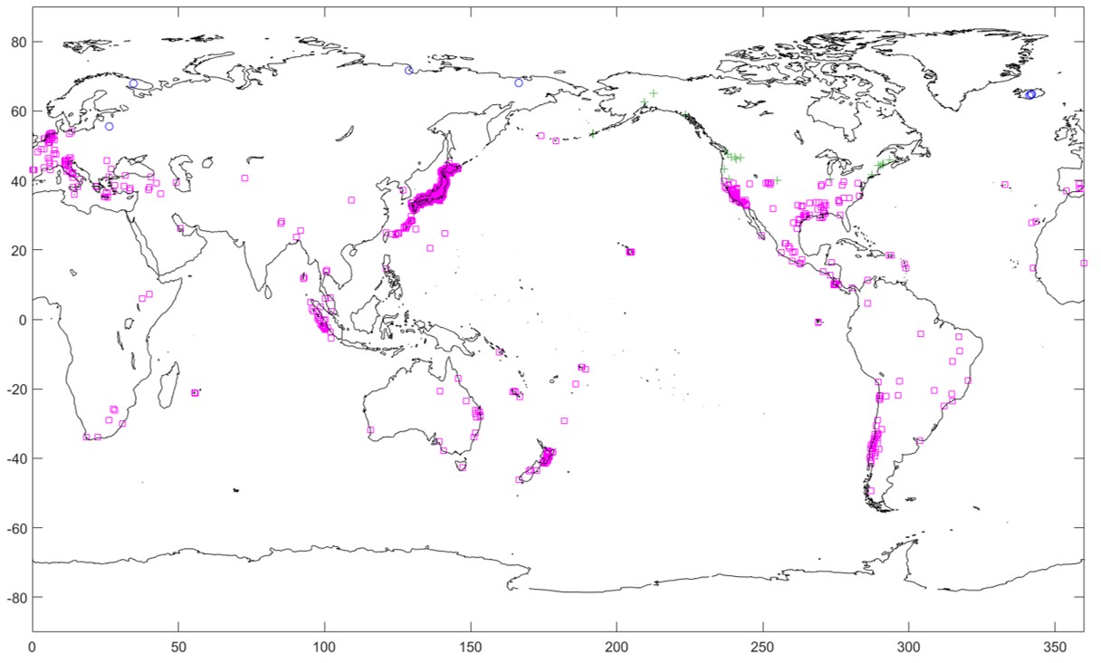
GPS stations removed by the automated ‘quality control’ process.
Maike has also been looking at using additional low pass filters (a statistical smoothing technique that identifies high-frequency ‘noise’) to remove the outliers, in order to move closer towards our ultimate aim of a GPS dataset that provides a ‘clean’ GIA signal.
(3) Updating previous Antarctic mass balance work to 2016
The approach we are using in GlobalMass – the use of a Bayesian Hierarchical Model (BHM) to combine observations and prior knowledge about physical processes – was initially developed and tested over Antarctica. The NERC-funded RATES (Resolving Antarctic ice mass TrEndS) project produced error-bounded trends of Antarctic ice mass balance from altimetry (CryoSat-2), GRACE and GPS datasets for the period 2003-2013.
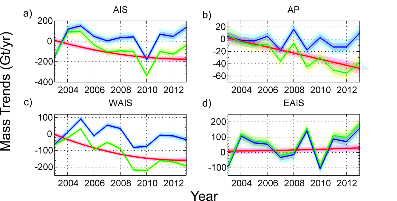
Ice mass balance trends from RATES for the Antarctic Peninsula (AP), West Antarctic Ice Sheet, (WAIS), East Antarctic Ice Sheet (EAIS) and Antarctic Ice Sheet as a whole (AIS). The total ice mass trend is shown in green, comprising a surface mass balance component (blue) and an ice dynamic component (red)
One of our initial aims is to update this time-series to the start of 2016, a period for which both CryoSat-2 and GRACE data are now available. Stephen Chuter has begun to prepare and format these datasets ahead of re-running the RATES BHM.
(4) Establishing a global salt budget
Finally, William Llovel has been undertaking a global salt budget study to understand if we can use it to improve estimates of ocean mass trends.
The basis for this work is that total observed sea level rise can be separated into two components: a ‘steric’ contribution (arising from changes in water temperature and salinity) and a ‘mass’ contribution (arising from the addition of new water – i.e. land ice melt – into the oceans). The steric component can be further partitioned into a ‘thermosteric’ signal (changes in water temperature) and a ‘halosteric’ signal (changes in water salinity). Such an approach must pay particular attention to the contribution from melting sea ice, which affects water salinity but not sea level.
Over the last few months, William has been defining the ‘halosteric’ signal at a global level. Ultimately, we are aiming to establish a global salt budget for 2005-2015, and then compare the estimated change in ocean mass with the that inferred from data from GRACE. Results from this work will be available later in the year.
Latest outputs
Zhe Sha was invited to give a talk at the TIES-GRASPA 2017 conference on Climate Climate and Environment in Bergamo, Italy. Her presentation (‘Bayesian estimation of global glacial isostatic adjustment for sea level rise re-evaluation‘) provided an explanation of how we are using a Bayesian Hierarchical Model (BHM) to develop a data-driven global solution for glacial isostatic adjustment (GIA).
We presented two posters at the Regional Sea Level Changes and Coastal Impacts conference in New York. Our first poster gave an overview of our statistical method and presented some initial results for global glacial isostatic adjustment (GIA) based on GPS data. Our second poster reviewed the contribution of land ice (ice sheets, glaciers and ice caps) to sea level rise during the ‘satellite era’ (i.e. the past 20 years or so).