
It’s been a couple of months since the last project update. In that time, we have been making progress in four main areas:
(1) Developing the statistical framework
The main purpose of our early experiments was to test and improve the Bayesian Hierarchical Model (BHM) – the statistical framework that is fundamental to the GlobalMass project. Although the method was previously applied successfully to Antarctica (in the NERC-funded RATES project), we are extending and expanding it to incorporate many more observations and processes on a global scale.
Changing how the framework operates has required considerable work and is in itself a significant output. It means that we are among the first to establish a complete statistical and computational framework of this type for Bayesian data assimilation models on a global scale. Zhe Sha and Jonty Rougier will be submitting a paper that summarises their approach later this year.
The paper will also introduce the ‘pseudo-polygon’ approach for addressing non-stationary spatial process with partial prior information. This provides us, for example, with a way of dealing with glacial isostatic adjustment (GIA), which is a significant signal in some parts of the world, but close to zero (with small error) in other regions. The pseudo-polygons allow us to ‘mask out’ those regions where we can be confident that GIA is negligible, but retain the full potential of the BHM approach for areas where we need to consider GIA.
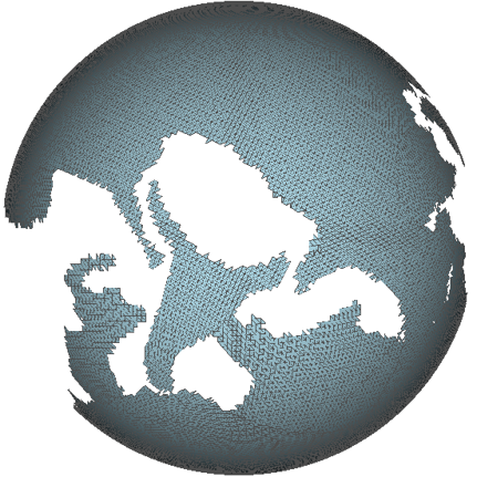
The pseudo-polygon approach allows regions of the global mesh to be removed while not impacting on the Bayesian approach in other areas.
(2) Finalising the GPS dataset
As reported previously, Maike Schumacher has been working to establish a global GPS dataset that provides a ‘clean’ GIA signal and is, therefore, suitable to investigate the behaviour of global GIA forward models. She has now fully developed a novel fully-automatic strategy to post-process the GPS time series and to correct for non-GIA artefacts.
The output is a dataset of ~4000 GPS vertical velocities that provide an observational estimate of global GIA uplift. We have compared this with 13 global GIA solutions, and the dataset will subsequently be used to improve existing global forward model solutions within our Bayesian Hierarchical Modelling framework through identification of statistically significant deviations between the observations and the models.
Maike will shortly be submitting a paper on her method and findings.
(3) Updating the Antarctic mass balance time-series
An initial aim of the land ice work package has been to update the RATES project. In this project, error-bounded trends of Antarctic ice mass balance were produced using a Bayesian framework from altimetry (CryoSat-2), GRACE and GPS datasets for the period 2003-2013. We want to update this time series up until the end of 2016, a period for which both CryoSat-2 and GRACE data are available.
Stephen Chuter has recently started to produce some preliminary results, updating Antarctic ice mass trends up to the end of 2015. We will provide more details on these later in the year, once we have had a chance to undertake more validation and interpretation.
(4) Contributing to the first WCRP global sea level budget assessment
We are also contributing to the first World Climate Research Programme (WCRP) global sea level budget (GSLB) assessment, a work-package of the WCRP Grand Challenge on ‘Regional Sea Level and Coastal Impacts‘ that is being coordinated by Anny Cazenave and Benoit Meyssignac. The GSLB assessment is a first attempt to provide annual estimates of the global sea level budget, involving multiple research groups worldwide. It is expected to result in a paper to be published in Earth System Science Data.
We have been asked to co-lead (with René Forsberg of DTU) the ‘Greenland’ section of the assessment, as well as to contribute (with our updated RATES results) to the ‘Antarctic’ section. More details to follow on this activity in the coming months.
Latest outputs
We delivered two presentations at the 1st circular Workshop on Glacial Isostatic Adjustment and Elastic Deformation held in Iceland in September. The first talk provided a review of the contribution of land ice (ice sheets, glaciers and ice caps) to sea level rise since 1992 (i.e. during the ‘satellite era’). The second talk presented the post-processing strategy we have developed to establish a novel GPS dataset that aims to provide a ‘clean’ signal with respect to glacial isostatic adjustment (GIA).
In October, Stephen Chuter gave a talk at the 2017 West Antarctica Ice Sheet (WAIS) workshop in Seattle, USA. His presentation (‘Mass budget reassessment of the Abbot and Getz sectors of West Antarctica‘) described how mass balance estimates for the Getz and Abbot drainage basins have been reassessed using improved ice thickness data from the CryoSat-2 satellite. The slides include a new animation of the estimated change in ice surface height between 2003 and 2012 due to ice dynamics (the flow of ice from the interior to the margins of the continent) and surface mass balance (SMB; the difference between snowfall and melt), based on the results of the RATES project.